
Repository Summary
| Checkout URI | https://github.com/SteveMacenski/spatio_temporal_voxel_layer.git |
| VCS Type | git |
| VCS Version | humble |
| Last Updated | 2025-04-15 |
| Dev Status | MAINTAINED |
| Released | RELEASED |
| Contributing |
Help Wanted (-)
Good First Issues (-) Pull Requests to Review (-) |
Packages
| Name | Version |
|---|---|
| openvdb_vendor | 2.3.4 |
| spatio_temporal_voxel_layer | 2.3.4 |
README
Spatio-Temporal Voxel Layer
This is a drop in replacement for the voxel_grid voxel representation of the environment. This package does a number of things to improve on the voxel grid package and extend the capabilities offered to the users, under a LGPL v2.1 license. Developed and maintained by Steven Macenski at Simbe Robotics.
This package sits on top of OpenVDB, an open-source C++ library built by Dreamworks “comprising a novel hierarchical data structure and a suite of tools for the efficient storage and manipulation of sparse volumetric data discretized on three-dimensional grids. It is developed and maintained by DreamWorks Animation for use in volumetric applications typically encountered in feature film production.”
Leveraging OpenVDB, we have the ability to efficiently maintain a 3 dimensional voxel-representative world space. We wrap this with ROS tools and interfaces to the navigation stack to allow for use of this layer in standard ROS configurations. It is certainly possible to utilize this package without ROS/Navigation and I invite other competing methodologies to develop here and create interfaces.
Sample videos are shown below of a robot using 7 depth cameras with less than 50% of a core, and another robot using a VLP-16.
| 7 Depth Cameras | VLP-16 LIDAR |
|---|---|
 |
 |
We found in experimental trials with 6 7hz dense stereo RGBD cameras we ran the major move_base process at 20-50% nominal from 80-110% on a 5th gen i7 CPU in the global costmap updating using the existing voxel_layer.
We’ve received feedback from users and have robots operating in the following environments with STVL:
- Retail
- Warehouses
- Factories
- Libraries
- Hospitals
- Hospitality
- RoboCup@Home
- Oil and Gas
Steve spoke at ROSCon 2018 about STVL and his presentation is linked here (or click on image).

Cite This Work
You can find this work here.
@article{doi:10.1177/1729881420910530,
    author = {Steve Macenski and David Tsai and Max Feinberg},
    title ={Spatio-temporal voxel layer: A view on robot perception for the dynamic world},
    journal = {International Journal of Advanced Robotic Systems},
    volume = {17},
    number = {2},
    year = {2020},
    doi = {10.1177/1729881420910530},
    URL = {https://doi.org/10.1177/1729881420910530}
}
Spatio-
The Spatio in this package is the representation of the environment in a configurable voxel_size voxel grid stored and searched by OpenVDB.
In addition, buffered measurement readings have the option to run an approximate voxel grid filter, parameterizable at runtime in the configuration yamls. It is incredibly useful to reduce spikes in move_base cpu due to dense measurement readings when getting close to objects (i.e. more points), but does increase the overhead very slightly (1-2%) for nominal operations. It’s a trade off but I recommend using it.
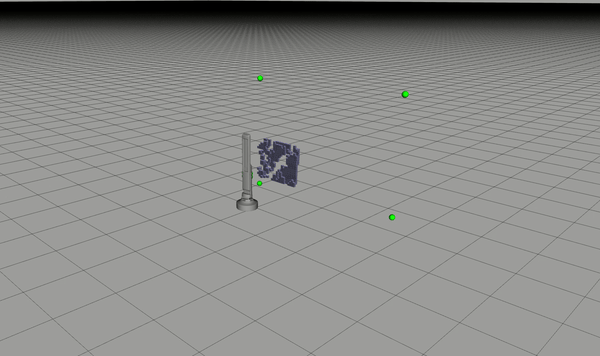
Below is an example a size of map that is trivial for the Spatio-Temportal Voxel Grid to maintain and render. This accounts for a 60,000 sq.ft. retail store with 710,765 voxels at a 0.05m resolution, with a size in memory of a mere 6.45MB.

-Temporal
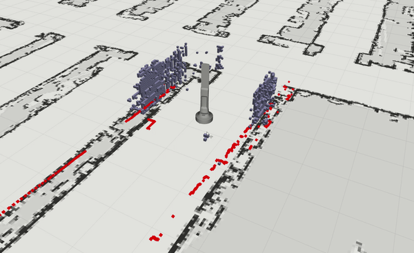
The Temporal in this package is the novel concept of voxel_decay whereas we have configurable functions that expire voxels and their occupation over time. Infrasture was created to store times in each voxel after which the voxel will disappear from the map. This is combined with checking inclusion of voxels in current measurement frustums to accelerate the decay of those voxels that do not have measurements but should if still in the scene and remain marked. This is done rather than simply clearing them naively or via costly raytracing. The time it takes to clear depends on the configured functions and acceleration factors.
Voxel acceleration uses given FOV to compute the frustum geometry. Depth cameras (e.g. Intel Realsense) are modeled with traditional 6-planed cubical frustums. 3D lidars (e.g. Velodyne VLP 16) are modeled with their hourglass-shaped FOV. Although many 3D lidars have 360 degree horizontal FOV, it is possible to use a narrower angle for the clearing frustum by setting the hFOV parameter accordingly.
Future extensions will also to query a static map and determine which connected components belong to the map, not in the map, or moving. Each of these three classes of blobs will have configurable models to control the time they persist, and if these things are reported to the user.
Below is an example of instantaneous decay, where readings in frustum are accelerated and decayed at each iteration. The models provided can be tuned to do this, or persist through linear or exponental equations. The second example has the acclerated frustum with tuned decay times and acceleration factors in navigation mode.

Local Costmap
This package utilizes all of the information coming in from the robot before the decay time for the local costmap. Rather than having a defined, discrete spatial barrier for the local planner to operate in, it instead relies on the user configuration of the layer to have a short decay time of voxels (1-30 seconds) so that you only plan in relavent space. This was a conscious design requirement since frequently the local planner should operate with more information than other times when the speed is greater or slower. This natively implements dynamic costmap scaling for speed.
It is the user’s responsibility to chose a decay time that makes sense for your robot’s local planner. 5-15 seconds I have found to be nominally good for most open-sourced local planner plugins. I do not recommend using this for planar lidars, 2D raytracing for professional grade lidars is sufficiently efficient and effective.
Global Costmap
Similar to the local costmap, the amount of information you want to store due to entropy in your scenes depend on your use-case. It is certainly possible to not decay the voxels in the global map at all. However, in practical application, I find a time 15-45 seconds to be a good balance due to things moving in the scene (i.e. store, warehouse, construction zone, office, etc). Permanent voxels set decay to -1. I do not recommend using this for planar lidars, 2D raytracing for professional grade lidars is sufficiently efficient and effective.
Mapping
As the images above suggest, you can use this to map an environment in 3D in realtime if you choose. If you enable mapping mode, then it will maintain the entire voxel grid and you can save the map using the services provided. At the moment, I support mapping but there is no probabilistic (yet!) marking framework, so what the sensor sees is what the map gets. This is likely to change in the near to middle term future as 3D localization becomes more interesting to the enterprise robotics community.
You can run multiple instances of the layer one to map and other to navigate if you want to navigate while mapping the environment. Mapping will also save incremental maps in the launch directory. Maps may be visualized using vdb_viewer. The costmap and occupancy point clouds will not generate in this mode from this layer. Utility functions are provided so you don’t need to learn anything about vdb files to convert to a pcl pointcloud in vdb2pc.hpp.
If you would like to be involved in this work, I would gladly take contributors and coauthors.
Installation
As of July 8 it is available via apt-get:
sudo apt-get install ros-kinetic-spatio-temporal-voxel-layer
Install from source
Required dependencies ROS Kinetic, navigation, OpenVDB, TBB.
sudo rosdep init && rosdep update && rosdep install --from-paths src --ignore-src -r -y
Configuration and Running
costmap_common_params.yaml
File truncated at 100 lines see the full file
CONTRIBUTING
Repository Summary
| Checkout URI | https://github.com/SteveMacenski/spatio_temporal_voxel_layer.git |
| VCS Type | git |
| VCS Version | jazzy |
| Last Updated | 2025-04-15 |
| Dev Status | MAINTAINED |
| Released | RELEASED |
| Contributing |
Help Wanted (-)
Good First Issues (-) Pull Requests to Review (-) |
Packages
| Name | Version |
|---|---|
| openvdb_vendor | 2.5.5 |
| spatio_temporal_voxel_layer | 2.5.5 |
README
Spatio-Temporal Voxel Layer
This is a drop in replacement for the voxel_grid voxel representation of the environment. This package does a number of things to improve on the voxel grid package and extend the capabilities offered to the users, under a LGPL v2.1 license. Developed and maintained by Steven Macenski at Simbe Robotics.
This package sits on top of OpenVDB, an open-source C++ library built by Dreamworks “comprising a novel hierarchical data structure and a suite of tools for the efficient storage and manipulation of sparse volumetric data discretized on three-dimensional grids. It is developed and maintained by DreamWorks Animation for use in volumetric applications typically encountered in feature film production.”
Leveraging OpenVDB, we have the ability to efficiently maintain a 3 dimensional voxel-representative world space. We wrap this with ROS tools and interfaces to the navigation stack to allow for use of this layer in standard ROS configurations. It is certainly possible to utilize this package without ROS/Navigation and I invite other competing methodologies to develop here and create interfaces.
Sample videos are shown below of a robot using 7 depth cameras with less than 50% of a core, and another robot using a VLP-16.
| 7 Depth Cameras | VLP-16 LIDAR |
|---|---|
|
|
We found in experimental trials with 6 7hz dense stereo RGBD cameras we ran the major move_base process at 20-50% nominal from 80-110% on a 5th gen i7 CPU in the global costmap updating using the existing voxel_layer.
We’ve received feedback from users and have robots operating in the following environments with STVL:
- Retail
- Warehouses
- Factories
- Libraries
- Hospitals
- Hospitality
- RoboCup@Home
- Oil and Gas
Steve spoke at ROSCon 2018 about STVL and his presentation is linked here (or click on image).
Cite This Work
You can find this work here.
@article{doi:10.1177/1729881420910530,
    author = {Steve Macenski and David Tsai and Max Feinberg},
    title ={Spatio-temporal voxel layer: A view on robot perception for the dynamic world},
    journal = {International Journal of Advanced Robotic Systems},
    volume = {17},
    number = {2},
    year = {2020},
    doi = {10.1177/1729881420910530},
    URL = {https://doi.org/10.1177/1729881420910530}
}
Spatio-
The Spatio in this package is the representation of the environment in a configurable voxel_size voxel grid stored and searched by OpenVDB.
In addition, buffered measurement readings have the option to run an approximate voxel grid filter, parameterizable at runtime in the configuration yamls. It is incredibly useful to reduce spikes in move_base cpu due to dense measurement readings when getting close to objects (i.e. more points), but does increase the overhead very slightly (1-2%) for nominal operations. It’s a trade off but I recommend using it.
Below is an example a size of map that is trivial for the Spatio-Temportal Voxel Grid to maintain and render. This accounts for a 60,000 sq.ft. retail store with 710,765 voxels at a 0.05m resolution, with a size in memory of a mere 6.45MB.
-Temporal
The Temporal in this package is the novel concept of voxel_decay whereas we have configurable functions that expire voxels and their occupation over time. Infrasture was created to store times in each voxel after which the voxel will disappear from the map. This is combined with checking inclusion of voxels in current measurement frustums to accelerate the decay of those voxels that do not have measurements but should if still in the scene and remain marked. This is done rather than simply clearing them naively or via costly raytracing. The time it takes to clear depends on the configured functions and acceleration factors.
Voxel acceleration uses given FOV to compute the frustum geometry. Depth cameras (e.g. Intel Realsense) are modeled with traditional 6-planed cubical frustums. 3D lidars (e.g. Velodyne VLP 16) are modeled with their hourglass-shaped FOV. Although many 3D lidars have 360 degree horizontal FOV, it is possible to use a narrower angle for the clearing frustum by setting the hFOV parameter accordingly.
Future extensions will also to query a static map and determine which connected components belong to the map, not in the map, or moving. Each of these three classes of blobs will have configurable models to control the time they persist, and if these things are reported to the user.
Below is an example of instantaneous decay, where readings in frustum are accelerated and decayed at each iteration. The models provided can be tuned to do this, or persist through linear or exponental equations. The second example has the acclerated frustum with tuned decay times and acceleration factors in navigation mode.
Local Costmap
This package utilizes all of the information coming in from the robot before the decay time for the local costmap. Rather than having a defined, discrete spatial barrier for the local planner to operate in, it instead relies on the user configuration of the layer to have a short decay time of voxels (1-30 seconds) so that you only plan in relavent space. This was a conscious design requirement since frequently the local planner should operate with more information than other times when the speed is greater or slower. This natively implements dynamic costmap scaling for speed.
It is the user’s responsibility to chose a decay time that makes sense for your robot’s local planner. 5-15 seconds I have found to be nominally good for most open-sourced local planner plugins. I do not recommend using this for planar lidars, 2D raytracing for professional grade lidars is sufficiently efficient and effective.
Global Costmap
Similar to the local costmap, the amount of information you want to store due to entropy in your scenes depend on your use-case. It is certainly possible to not decay the voxels in the global map at all. However, in practical application, I find a time 15-45 seconds to be a good balance due to things moving in the scene (i.e. store, warehouse, construction zone, office, etc). Permanent voxels set decay to -1. I do not recommend using this for planar lidars, 2D raytracing for professional grade lidars is sufficiently efficient and effective.
Mapping
As the images above suggest, you can use this to map an environment in 3D in realtime if you choose. If you enable mapping mode, then it will maintain the entire voxel grid and you can save the map using the services provided. At the moment, I support mapping but there is no probabilistic (yet!) marking framework, so what the sensor sees is what the map gets. This is likely to change in the near to middle term future as 3D localization becomes more interesting to the enterprise robotics community.
You can run multiple instances of the layer one to map and other to navigate if you want to navigate while mapping the environment. Mapping will also save incremental maps in the launch directory. Maps may be visualized using vdb_viewer. The costmap and occupancy point clouds will not generate in this mode from this layer. Utility functions are provided so you don’t need to learn anything about vdb files to convert to a pcl pointcloud in vdb2pc.hpp.
If you would like to be involved in this work, I would gladly take contributors and coauthors.
Installation
As of July 8 it is available via apt-get:
sudo apt-get install ros-kinetic-spatio-temporal-voxel-layer
Install from source
Required dependencies ROS Kinetic, navigation, OpenVDB, TBB.
sudo rosdep init && rosdep update && rosdep install --from-paths src --ignore-src -r -y
Configuration and Running
costmap_common_params.yaml
File truncated at 100 lines see the full file
CONTRIBUTING
Repository Summary
| Checkout URI | https://github.com/SteveMacenski/spatio_temporal_voxel_layer.git |
| VCS Type | git |
| VCS Version | kilted |
| Last Updated | 2026-01-06 |
| Dev Status | MAINTAINED |
| Released | RELEASED |
| Contributing |
Help Wanted (-)
Good First Issues (-) Pull Requests to Review (-) |
Packages
| Name | Version |
|---|---|
| openvdb_vendor | 2.6.2 |
| spatio_temporal_voxel_layer | 2.6.2 |
README
Spatio-Temporal Voxel Layer
This is a drop in replacement for the voxel_grid voxel representation of the environment. This package does a number of things to improve on the voxel grid package and extend the capabilities offered to the users, under a LGPL v2.1 license. Developed and maintained by Steven Macenski at Simbe Robotics.
This package sits on top of OpenVDB, an open-source C++ library built by Dreamworks “comprising a novel hierarchical data structure and a suite of tools for the efficient storage and manipulation of sparse volumetric data discretized on three-dimensional grids. It is developed and maintained by DreamWorks Animation for use in volumetric applications typically encountered in feature film production.”
Leveraging OpenVDB, we have the ability to efficiently maintain a 3 dimensional voxel-representative world space. We wrap this with ROS tools and interfaces to the navigation stack to allow for use of this layer in standard ROS configurations. It is certainly possible to utilize this package without ROS/Navigation and I invite other competing methodologies to develop here and create interfaces.
Sample videos are shown below of a robot using 7 depth cameras with less than 50% of a core, and another robot using a VLP-16.
| 7 Depth Cameras | VLP-16 LIDAR |
|---|---|
|
|
We found in experimental trials with 6 7hz dense stereo RGBD cameras we ran the major move_base process at 20-50% nominal from 80-110% on a 5th gen i7 CPU in the global costmap updating using the existing voxel_layer.
We’ve received feedback from users and have robots operating in the following environments with STVL:
- Retail
- Warehouses
- Factories
- Libraries
- Hospitals
- Hospitality
- RoboCup@Home
- Oil and Gas
Steve spoke at ROSCon 2018 about STVL and his presentation is linked here (or click on image).
Cite This Work
You can find this work here.
@article{doi:10.1177/1729881420910530,
    author = {Steve Macenski and David Tsai and Max Feinberg},
    title ={Spatio-temporal voxel layer: A view on robot perception for the dynamic world},
    journal = {International Journal of Advanced Robotic Systems},
    volume = {17},
    number = {2},
    year = {2020},
    doi = {10.1177/1729881420910530},
    URL = {https://doi.org/10.1177/1729881420910530}
}
Spatio-
The Spatio in this package is the representation of the environment in a configurable voxel_size voxel grid stored and searched by OpenVDB.
In addition, buffered measurement readings have the option to run an approximate voxel grid filter, parameterizable at runtime in the configuration yamls. It is incredibly useful to reduce spikes in move_base cpu due to dense measurement readings when getting close to objects (i.e. more points), but does increase the overhead very slightly (1-2%) for nominal operations. It’s a trade off but I recommend using it.
Below is an example a size of map that is trivial for the Spatio-Temportal Voxel Grid to maintain and render. This accounts for a 60,000 sq.ft. retail store with 710,765 voxels at a 0.05m resolution, with a size in memory of a mere 6.45MB.
-Temporal
The Temporal in this package is the novel concept of voxel_decay whereas we have configurable functions that expire voxels and their occupation over time. Infrasture was created to store times in each voxel after which the voxel will disappear from the map. This is combined with checking inclusion of voxels in current measurement frustums to accelerate the decay of those voxels that do not have measurements but should if still in the scene and remain marked. This is done rather than simply clearing them naively or via costly raytracing. The time it takes to clear depends on the configured functions and acceleration factors.
Voxel acceleration uses given FOV to compute the frustum geometry. Depth cameras (e.g. Intel Realsense) are modeled with traditional 6-planed cubical frustums. 3D lidars (e.g. Velodyne VLP 16) are modeled with their hourglass-shaped FOV. Although many 3D lidars have 360 degree horizontal FOV, it is possible to use a narrower angle for the clearing frustum by setting the hFOV parameter accordingly.
Future extensions will also to query a static map and determine which connected components belong to the map, not in the map, or moving. Each of these three classes of blobs will have configurable models to control the time they persist, and if these things are reported to the user.
Below is an example of instantaneous decay, where readings in frustum are accelerated and decayed at each iteration. The models provided can be tuned to do this, or persist through linear or exponental equations. The second example has the acclerated frustum with tuned decay times and acceleration factors in navigation mode.
Local Costmap
This package utilizes all of the information coming in from the robot before the decay time for the local costmap. Rather than having a defined, discrete spatial barrier for the local planner to operate in, it instead relies on the user configuration of the layer to have a short decay time of voxels (1-30 seconds) so that you only plan in relavent space. This was a conscious design requirement since frequently the local planner should operate with more information than other times when the speed is greater or slower. This natively implements dynamic costmap scaling for speed.
It is the user’s responsibility to chose a decay time that makes sense for your robot’s local planner. 5-15 seconds I have found to be nominally good for most open-sourced local planner plugins. I do not recommend using this for planar lidars, 2D raytracing for professional grade lidars is sufficiently efficient and effective.
Global Costmap
Similar to the local costmap, the amount of information you want to store due to entropy in your scenes depend on your use-case. It is certainly possible to not decay the voxels in the global map at all. However, in practical application, I find a time 15-45 seconds to be a good balance due to things moving in the scene (i.e. store, warehouse, construction zone, office, etc). Permanent voxels set decay to -1. I do not recommend using this for planar lidars, 2D raytracing for professional grade lidars is sufficiently efficient and effective.
Mapping
As the images above suggest, you can use this to map an environment in 3D in realtime if you choose. If you enable mapping mode, then it will maintain the entire voxel grid and you can save the map using the services provided. At the moment, I support mapping but there is no probabilistic (yet!) marking framework, so what the sensor sees is what the map gets. This is likely to change in the near to middle term future as 3D localization becomes more interesting to the enterprise robotics community.
You can run multiple instances of the layer one to map and other to navigate if you want to navigate while mapping the environment. Mapping will also save incremental maps in the launch directory. Maps may be visualized using vdb_viewer. The costmap and occupancy point clouds will not generate in this mode from this layer. Utility functions are provided so you don’t need to learn anything about vdb files to convert to a pcl pointcloud in vdb2pc.hpp.
If you would like to be involved in this work, I would gladly take contributors and coauthors.
Installation
As of July 8 it is available via apt-get:
sudo apt-get install ros-kinetic-spatio-temporal-voxel-layer
Install from source
Required dependencies ROS Kinetic, navigation, OpenVDB, TBB.
sudo rosdep init && rosdep update && rosdep install --from-paths src --ignore-src -r -y
Configuration and Running
costmap_common_params.yaml
File truncated at 100 lines see the full file
CONTRIBUTING
Repository Summary
| Checkout URI | https://github.com/SteveMacenski/spatio_temporal_voxel_layer.git |
| VCS Type | git |
| VCS Version | humble |
| Last Updated | 2025-04-15 |
| Dev Status | MAINTAINED |
| Released | RELEASED |
| Contributing |
Help Wanted (-)
Good First Issues (-) Pull Requests to Review (-) |
Packages
| Name | Version |
|---|---|
| openvdb_vendor | 2.3.4 |
| spatio_temporal_voxel_layer | 2.3.4 |
README
Spatio-Temporal Voxel Layer
This is a drop in replacement for the voxel_grid voxel representation of the environment. This package does a number of things to improve on the voxel grid package and extend the capabilities offered to the users, under a LGPL v2.1 license. Developed and maintained by Steven Macenski at Simbe Robotics.
This package sits on top of OpenVDB, an open-source C++ library built by Dreamworks “comprising a novel hierarchical data structure and a suite of tools for the efficient storage and manipulation of sparse volumetric data discretized on three-dimensional grids. It is developed and maintained by DreamWorks Animation for use in volumetric applications typically encountered in feature film production.”
Leveraging OpenVDB, we have the ability to efficiently maintain a 3 dimensional voxel-representative world space. We wrap this with ROS tools and interfaces to the navigation stack to allow for use of this layer in standard ROS configurations. It is certainly possible to utilize this package without ROS/Navigation and I invite other competing methodologies to develop here and create interfaces.
Sample videos are shown below of a robot using 7 depth cameras with less than 50% of a core, and another robot using a VLP-16.
| 7 Depth Cameras | VLP-16 LIDAR |
|---|---|
|
|
We found in experimental trials with 6 7hz dense stereo RGBD cameras we ran the major move_base process at 20-50% nominal from 80-110% on a 5th gen i7 CPU in the global costmap updating using the existing voxel_layer.
We’ve received feedback from users and have robots operating in the following environments with STVL:
- Retail
- Warehouses
- Factories
- Libraries
- Hospitals
- Hospitality
- RoboCup@Home
- Oil and Gas
Steve spoke at ROSCon 2018 about STVL and his presentation is linked here (or click on image).
Cite This Work
You can find this work here.
@article{doi:10.1177/1729881420910530,
    author = {Steve Macenski and David Tsai and Max Feinberg},
    title ={Spatio-temporal voxel layer: A view on robot perception for the dynamic world},
    journal = {International Journal of Advanced Robotic Systems},
    volume = {17},
    number = {2},
    year = {2020},
    doi = {10.1177/1729881420910530},
    URL = {https://doi.org/10.1177/1729881420910530}
}
Spatio-
The Spatio in this package is the representation of the environment in a configurable voxel_size voxel grid stored and searched by OpenVDB.
In addition, buffered measurement readings have the option to run an approximate voxel grid filter, parameterizable at runtime in the configuration yamls. It is incredibly useful to reduce spikes in move_base cpu due to dense measurement readings when getting close to objects (i.e. more points), but does increase the overhead very slightly (1-2%) for nominal operations. It’s a trade off but I recommend using it.
Below is an example a size of map that is trivial for the Spatio-Temportal Voxel Grid to maintain and render. This accounts for a 60,000 sq.ft. retail store with 710,765 voxels at a 0.05m resolution, with a size in memory of a mere 6.45MB.
-Temporal
The Temporal in this package is the novel concept of voxel_decay whereas we have configurable functions that expire voxels and their occupation over time. Infrasture was created to store times in each voxel after which the voxel will disappear from the map. This is combined with checking inclusion of voxels in current measurement frustums to accelerate the decay of those voxels that do not have measurements but should if still in the scene and remain marked. This is done rather than simply clearing them naively or via costly raytracing. The time it takes to clear depends on the configured functions and acceleration factors.
Voxel acceleration uses given FOV to compute the frustum geometry. Depth cameras (e.g. Intel Realsense) are modeled with traditional 6-planed cubical frustums. 3D lidars (e.g. Velodyne VLP 16) are modeled with their hourglass-shaped FOV. Although many 3D lidars have 360 degree horizontal FOV, it is possible to use a narrower angle for the clearing frustum by setting the hFOV parameter accordingly.
Future extensions will also to query a static map and determine which connected components belong to the map, not in the map, or moving. Each of these three classes of blobs will have configurable models to control the time they persist, and if these things are reported to the user.
Below is an example of instantaneous decay, where readings in frustum are accelerated and decayed at each iteration. The models provided can be tuned to do this, or persist through linear or exponental equations. The second example has the acclerated frustum with tuned decay times and acceleration factors in navigation mode.
Local Costmap
This package utilizes all of the information coming in from the robot before the decay time for the local costmap. Rather than having a defined, discrete spatial barrier for the local planner to operate in, it instead relies on the user configuration of the layer to have a short decay time of voxels (1-30 seconds) so that you only plan in relavent space. This was a conscious design requirement since frequently the local planner should operate with more information than other times when the speed is greater or slower. This natively implements dynamic costmap scaling for speed.
It is the user’s responsibility to chose a decay time that makes sense for your robot’s local planner. 5-15 seconds I have found to be nominally good for most open-sourced local planner plugins. I do not recommend using this for planar lidars, 2D raytracing for professional grade lidars is sufficiently efficient and effective.
Global Costmap
Similar to the local costmap, the amount of information you want to store due to entropy in your scenes depend on your use-case. It is certainly possible to not decay the voxels in the global map at all. However, in practical application, I find a time 15-45 seconds to be a good balance due to things moving in the scene (i.e. store, warehouse, construction zone, office, etc). Permanent voxels set decay to -1. I do not recommend using this for planar lidars, 2D raytracing for professional grade lidars is sufficiently efficient and effective.
Mapping
As the images above suggest, you can use this to map an environment in 3D in realtime if you choose. If you enable mapping mode, then it will maintain the entire voxel grid and you can save the map using the services provided. At the moment, I support mapping but there is no probabilistic (yet!) marking framework, so what the sensor sees is what the map gets. This is likely to change in the near to middle term future as 3D localization becomes more interesting to the enterprise robotics community.
You can run multiple instances of the layer one to map and other to navigate if you want to navigate while mapping the environment. Mapping will also save incremental maps in the launch directory. Maps may be visualized using vdb_viewer. The costmap and occupancy point clouds will not generate in this mode from this layer. Utility functions are provided so you don’t need to learn anything about vdb files to convert to a pcl pointcloud in vdb2pc.hpp.
If you would like to be involved in this work, I would gladly take contributors and coauthors.
Installation
As of July 8 it is available via apt-get:
sudo apt-get install ros-kinetic-spatio-temporal-voxel-layer
Install from source
Required dependencies ROS Kinetic, navigation, OpenVDB, TBB.
sudo rosdep init && rosdep update && rosdep install --from-paths src --ignore-src -r -y
Configuration and Running
costmap_common_params.yaml
File truncated at 100 lines see the full file
CONTRIBUTING
Repository Summary
| Checkout URI | https://github.com/SteveMacenski/spatio_temporal_voxel_layer.git |
| VCS Type | git |
| VCS Version | eloquent-devel |
| Last Updated | 2020-05-02 |
| Dev Status | MAINTAINED |
| Released | RELEASED |
| Contributing |
Help Wanted (-)
Good First Issues (-) Pull Requests to Review (-) |
Packages
| Name | Version |
|---|---|
| spatio_temporal_voxel_layer | 2.1.3 |
README
Spatio-Temporal Voxel Layer 
This is a drop in replacement for the voxel_grid voxel representation of the environment. This package does a number of things to improve on the voxel grid package and extend the capabilities offered to the users, under a LGPL v2.1 license. Developed and maintained by Steven Macenski at Simbe Robotics.
This package sits on top of OpenVDB, an open-source C++ library built by Dreamworks “comprising a novel hierarchical data structure and a suite of tools for the efficient storage and manipulation of sparse volumetric data discretized on three-dimensional grids. It is developed and maintained by DreamWorks Animation for use in volumetric applications typically encountered in feature film production.”
Leveraging OpenVDB, we have the ability to efficiently maintain a 3 dimensional voxel-representative world space. We wrap this with ROS tools and interfaces to the navigation stack to allow for use of this layer in standard ROS configurations. It is certainly possible to utilize this package without ROS/Navigation and I invite other competing methodologies to develop here and create interfaces.
Sample videos are shown below of a robot using 7 depth cameras with less than 50% of a core, and another robot using a VLP-16.
| 7 Depth Cameras | VLP-16 LIDAR |
|---|---|
|
|
We found in experimental trials with 6 7hz dense stereo RGBD cameras we ran the major move_base process at 20-50% nominal from 80-110% on a 5th gen i7 CPU in the global costmap updating using the existing voxel_layer.
We’ve received feedback from users and have robots operating in the following environments with STVL:
- Retail
- Warehouses
- Factories
- Libraries
- Hospitals
- Hospitality
- RoboCup@Home
- Oil and Gas
Steve spoke at ROSCon 2018 about STVL and his presentation is linked here (or click on image).
Cite This Work
You can find this work here.
@article{doi:10.1177/1729881420910530,
    author = {Steve Macenski and David Tsai and Max Feinberg},
    title ={Spatio-temporal voxel layer: A view on robot perception for the dynamic world},
    journal = {International Journal of Advanced Robotic Systems},
    volume = {17},
    number = {2},
    year = {2020},
    doi = {10.1177/1729881420910530},
    URL = {https://doi.org/10.1177/1729881420910530}
}
Spatio-
The Spatio in this package is the representation of the environment in a configurable voxel_size voxel grid stored and searched by OpenVDB.
In addition, buffered measurement readings have the option to run an approximate voxel grid filter, parameterizable at runtime in the configuration yamls. It is incredibly useful to reduce spikes in move_base cpu due to dense measurement readings when getting close to objects (i.e. more points), but does increase the overhead very slightly (1-2%) for nominal operations. It’s a trade off but I recommend using it.
Below is an example a size of map that is trivial for the Spatio-Temportal Voxel Grid to maintain and render. This accounts for a 60,000 sq.ft. retail store with 710,765 voxels at a 0.05m resolution, with a size in memory of a mere 6.45MB.
-Temporal
The Temporal in this package is the novel concept of voxel_decay whereas we have configurable functions that expire voxels and their occupation over time. Infrasture was created to store times in each voxel after which the voxel will disappear from the map. This is combined with checking inclusion of voxels in current measurement frustums to accelerate the decay of those voxels that do not have measurements but should if still in the scene and remain marked. This is done rather than simply clearing them naively or via costly raytracing. The time it takes to clear depends on the configured functions and acceleration factors.
Voxel acceleration uses given FOV to compute the frustum geometry. Depth cameras (e.g. Intel Realsense) are modeled with traditional 6-planed cubical frustums. 3D lidars (e.g. Velodyne VLP 16) are modeled with their hourglass-shaped FOV. Although many 3D lidars have 360 degree horizontal FOV, it is possible to use a narrower angle for the clearing frustum by setting the hFOV parameter accordingly.
Future extensions will also to query a static map and determine which connected components belong to the map, not in the map, or moving. Each of these three classes of blobs will have configurable models to control the time they persist, and if these things are reported to the user.
Below is an example of instantaneous decay, where readings in frustum are accelerated and decayed at each iteration. The models provided can be tuned to do this, or persist through linear or exponental equations. The second example has the acclerated frustum with tuned decay times and acceleration factors in navigation mode.
Local Costmap
This package utilizes all of the information coming in from the robot before the decay time for the local costmap. Rather than having a defined, discrete spatial barrier for the local planner to operate in, it instead relies on the user configuration of the layer to have a short decay time of voxels (1-30 seconds) so that you only plan in relavent space. This was a conscious design requirement since frequently the local planner should operate with more information than other times when the speed is greater or slower. This natively implements dynamic costmap scaling for speed.
It is the user’s responsibility to chose a decay time that makes sense for your robot’s local planner. 5-15 seconds I have found to be nominally good for most open-sourced local planner plugins. I do not recommend using this for planar lidars, 2D raytracing for professional grade lidars is sufficiently efficient and effective.
Global Costmap
Similar to the local costmap, the amount of information you want to store due to entropy in your scenes depend on your use-case. It is certainly possible to not decay the voxels in the global map at all. However, in practical application, I find a time 15-45 seconds to be a good balance due to things moving in the scene (i.e. store, warehouse, construction zone, office, etc). Permanent voxels set decay to -1. I do not recommend using this for planar lidars, 2D raytracing for professional grade lidars is sufficiently efficient and effective.
Mapping
As the images above suggest, you can use this to map an environment in 3D in realtime if you choose. If you enable mapping mode, then it will maintain the entire voxel grid and you can save the map using the services provided. At the moment, I support mapping but there is no probabilistic (yet!) marking framework, so what the sensor sees is what the map gets. This is likely to change in the near to middle term future as 3D localization becomes more interesting to the enterprise robotics community.
You can run multiple instances of the layer one to map and other to navigate if you want to navigate while mapping the environment. Mapping will also save incremental maps in the launch directory. Maps may be visualized using vdb_viewer. The costmap and occupancy point clouds will not generate in this mode from this layer. Utility functions are provided so you don’t need to learn anything about vdb files to convert to a pcl pointcloud in vdb2pc.hpp.
If you would like to be involved in this work, I would gladly take contributors and coauthors.
Installation
As of July 8 it is available via apt-get:
sudo apt-get install ros-kinetic-spatio-temporal-voxel-layer
Install from source
Required dependencies ROS Kinetic, navigation, OpenVDB, TBB.
sudo rosdep init && rosdep update && rosdep install --from-paths src --ignore-src -r -y
Configuration and Running
costmap_common_params.yaml
File truncated at 100 lines see the full file
CONTRIBUTING
Repository Summary
| Checkout URI | https://github.com/SteveMacenski/spatio_temporal_voxel_layer.git |
| VCS Type | git |
| VCS Version | dashing-devel |
| Last Updated | 2020-01-31 |
| Dev Status | MAINTAINED |
| Released | RELEASED |
| Contributing |
Help Wanted (-)
Good First Issues (-) Pull Requests to Review (-) |
Packages
| Name | Version |
|---|---|
| spatio_temporal_voxel_layer | 2.0.2 |
README
Spatio-Temporal Voxel Layer 
This is a drop in replacement for the voxel_grid voxel representation of the environment. This package does a number of things to improve on the voxel grid package and extend the capabilities offered to the users, under a LGPL v2.1 license. Developed and maintained by Steven Macenski at Simbe Robotics.
This package sits on top of OpenVDB, an open-source C++ library built by Dreamworks “comprising a novel hierarchical data structure and a suite of tools for the efficient storage and manipulation of sparse volumetric data discretized on three-dimensional grids. It is developed and maintained by DreamWorks Animation for use in volumetric applications typically encountered in feature film production.”
Leveraging OpenVDB, we have the ability to efficiently maintain a 3 dimensional voxel-representative world space. We wrap this with ROS tools and interfaces to the navigation stack to allow for use of this layer in standard ROS configurations. It is certainly possible to utilize this package without ROS/Navigation and I invite other competing methodologies to develop here and create interfaces.
Sample videos are shown below of a robot using 7 depth cameras with less than 50% of a core, and another robot using a VLP-16.
| 7 Depth Cameras | VLP-16 LIDAR |
|---|---|
|
|
We found in experimental trials with 6 7hz dense stereo RGBD cameras we ran the major move_base process at 20-50% nominal from 80-110% on a 5th gen i7 CPU in the global costmap updating using the existing voxel_layer.
We’ve received feedback from users and have robots operating in the following environments with STVL:
- Retail
- Warehouses
- Factories
- Libraries
- Hospitals
- Hospitality
- RoboCup@Home
- Oil and Gas
Steve spoke at ROSCon 2018 about STVL and his presentation is linked here (or click on image).
Spatio-
The Spatio in this package is the representation of the environment in a configurable voxel_size voxel grid stored and searched by OpenVDB.
In addition, buffered measurement readings have the option to run an approximate voxel grid filter, parameterizable at runtime in the configuration yamls. It is incredibly useful to reduce spikes in move_base cpu due to dense measurement readings when getting close to objects (i.e. more points), but does increase the overhead very slightly (1-2%) for nominal operations. It’s a trade off but I recommend using it.
Below is an example a size of map that is trivial for the Spatio-Temportal Voxel Grid to maintain and render. This accounts for a 60,000 sq.ft. retail store with 710,765 voxels at a 0.05m resolution, with a size in memory of a mere 6.45MB.
-Temporal
The Temporal in this package is the novel concept of voxel_decay whereas we have configurable functions that expire voxels and their occupation over time. Infrasture was created to store times in each voxel after which the voxel will disappear from the map. This is combined with checking inclusion of voxels in current measurement frustums to accelerate the decay of those voxels that do not have measurements but should if still in the scene and remain marked. This is done rather than simply clearing them naively or via costly raytracing. The time it takes to clear depends on the configured functions and acceleration factors.
Voxel acceleration uses given FOV to compute the frustum geometry. Depth cameras (e.g. Intel Realsense) are modeled with traditional 6-planed cubical frustums. 3D lidars (e.g. Velodyne VLP 16) are modeled with their hourglass-shaped FOV. Although many 3D lidars have 360 degree horizontal FOV, it is possible to use a narrower angle for the clearing frustum by setting the hFOV parameter accordingly.
Future extensions will also to query a static map and determine which connected components belong to the map, not in the map, or moving. Each of these three classes of blobs will have configurable models to control the time they persist, and if these things are reported to the user.
Below is an example of instantaneous decay, where readings in frustum are accelerated and decayed at each iteration. The models provided can be tuned to do this, or persist through linear or exponental equations. The second example has the acclerated frustum with tuned decay times and acceleration factors in navigation mode.
Local Costmap
This package utilizes all of the information coming in from the robot before the decay time for the local costmap. Rather than having a defined, discrete spatial barrier for the local planner to operate in, it instead relies on the user configuration of the layer to have a short decay time of voxels (1-30 seconds) so that you only plan in relavent space. This was a conscious design requirement since frequently the local planner should operate with more information than other times when the speed is greater or slower. This natively implements dynamic costmap scaling for speed.
It is the user’s responsibility to chose a decay time that makes sense for your robot’s local planner. 5-15 seconds I have found to be nominally good for most open-sourced local planner plugins. I do not recommend using this for planar lidars, 2D raytracing for professional grade lidars is sufficiently efficient and effective.
Global Costmap
Similar to the local costmap, the amount of information you want to store due to entropy in your scenes depend on your use-case. It is certainly possible to not decay the voxels in the global map at all. However, in practical application, I find a time 15-45 seconds to be a good balance due to things moving in the scene (i.e. store, warehouse, construction zone, office, etc). Permanent voxels set decay to -1. I do not recommend using this for planar lidars, 2D raytracing for professional grade lidars is sufficiently efficient and effective.
Mapping
As the images above suggest, you can use this to map an environment in 3D in realtime if you choose. If you enable mapping mode, then it will maintain the entire voxel grid and you can save the map using the services provided. At the moment, I support mapping but there is no probabilistic (yet!) marking framework, so what the sensor sees is what the map gets. This is likely to change in the near to middle term future as 3D localization becomes more interesting to the enterprise robotics community.
You can run multiple instances of the layer one to map and other to navigate if you want to navigate while mapping the environment. Mapping will also save incremental maps in the launch directory. Maps may be visualized using vdb_viewer. The costmap and occupancy point clouds will not generate in this mode from this layer. Utility functions are provided so you don’t need to learn anything about vdb files to convert to a pcl pointcloud in vdb2pc.hpp.
If you would like to be involved in this work, I would gladly take contributors and coauthors.
Installation
As of July 8 it is available via apt-get:
sudo apt-get install ros-kinetic-spatio-temporal-voxel-layer
Install from source
Required dependencies ROS Kinetic, navigation, OpenVDB, TBB.
sudo rosdep init && rosdep update && rosdep install --from-paths src --ignore-src -r -y
Configuration and Running
costmap_common_params.yaml
An example fully-described configuration is shown below.
``` rgbd_obstacle_layer: enabled: true voxel_decay: 20 #seconds if linear, e^n if exponential decay_model: 0 #0=linear, 1=exponential, -1=persistent voxel_size: 0.05 #meters track_unknown_space: true #default space is unknown observation_persistence: 0.0 #seconds max_obstacle_height: 2.0 #meters unknown_threshold: 15 #voxel height mark_threshold: 0 #voxel height update_footprint_enabled: true combination_method: 1 #1=max, 0=override obstacle_range: 3.0 #meters
File truncated at 100 lines see the full file
CONTRIBUTING
Repository Summary
| Checkout URI | https://github.com/SteveMacenski/spatio_temporal_voxel_layer.git |
| VCS Type | git |
| VCS Version | galactic |
| Last Updated | 2021-12-15 |
| Dev Status | MAINTAINED |
| Released | RELEASED |
| Contributing |
Help Wanted (-)
Good First Issues (-) Pull Requests to Review (-) |
Packages
| Name | Version |
|---|---|
| spatio_temporal_voxel_layer | 2.2.0 |
README
Spatio-Temporal Voxel Layer
This is a drop in replacement for the voxel_grid voxel representation of the environment. This package does a number of things to improve on the voxel grid package and extend the capabilities offered to the users, under a LGPL v2.1 license. Developed and maintained by Steven Macenski at Simbe Robotics.
This package sits on top of OpenVDB, an open-source C++ library built by Dreamworks “comprising a novel hierarchical data structure and a suite of tools for the efficient storage and manipulation of sparse volumetric data discretized on three-dimensional grids. It is developed and maintained by DreamWorks Animation for use in volumetric applications typically encountered in feature film production.”
Leveraging OpenVDB, we have the ability to efficiently maintain a 3 dimensional voxel-representative world space. We wrap this with ROS tools and interfaces to the navigation stack to allow for use of this layer in standard ROS configurations. It is certainly possible to utilize this package without ROS/Navigation and I invite other competing methodologies to develop here and create interfaces.
Sample videos are shown below of a robot using 7 depth cameras with less than 50% of a core, and another robot using a VLP-16.
| 7 Depth Cameras | VLP-16 LIDAR |
|---|---|
|
|
We found in experimental trials with 6 7hz dense stereo RGBD cameras we ran the major move_base process at 20-50% nominal from 80-110% on a 5th gen i7 CPU in the global costmap updating using the existing voxel_layer.
We’ve received feedback from users and have robots operating in the following environments with STVL:
- Retail
- Warehouses
- Factories
- Libraries
- Hospitals
- Hospitality
- RoboCup@Home
- Oil and Gas
Steve spoke at ROSCon 2018 about STVL and his presentation is linked here (or click on image).
Cite This Work
You can find this work here.
@article{doi:10.1177/1729881420910530,
    author = {Steve Macenski and David Tsai and Max Feinberg},
    title ={Spatio-temporal voxel layer: A view on robot perception for the dynamic world},
    journal = {International Journal of Advanced Robotic Systems},
    volume = {17},
    number = {2},
    year = {2020},
    doi = {10.1177/1729881420910530},
    URL = {https://doi.org/10.1177/1729881420910530}
}
Spatio-
The Spatio in this package is the representation of the environment in a configurable voxel_size voxel grid stored and searched by OpenVDB.
In addition, buffered measurement readings have the option to run an approximate voxel grid filter, parameterizable at runtime in the configuration yamls. It is incredibly useful to reduce spikes in move_base cpu due to dense measurement readings when getting close to objects (i.e. more points), but does increase the overhead very slightly (1-2%) for nominal operations. It’s a trade off but I recommend using it.
Below is an example a size of map that is trivial for the Spatio-Temportal Voxel Grid to maintain and render. This accounts for a 60,000 sq.ft. retail store with 710,765 voxels at a 0.05m resolution, with a size in memory of a mere 6.45MB.
-Temporal
The Temporal in this package is the novel concept of voxel_decay whereas we have configurable functions that expire voxels and their occupation over time. Infrasture was created to store times in each voxel after which the voxel will disappear from the map. This is combined with checking inclusion of voxels in current measurement frustums to accelerate the decay of those voxels that do not have measurements but should if still in the scene and remain marked. This is done rather than simply clearing them naively or via costly raytracing. The time it takes to clear depends on the configured functions and acceleration factors.
Voxel acceleration uses given FOV to compute the frustum geometry. Depth cameras (e.g. Intel Realsense) are modeled with traditional 6-planed cubical frustums. 3D lidars (e.g. Velodyne VLP 16) are modeled with their hourglass-shaped FOV. Although many 3D lidars have 360 degree horizontal FOV, it is possible to use a narrower angle for the clearing frustum by setting the hFOV parameter accordingly.
Future extensions will also to query a static map and determine which connected components belong to the map, not in the map, or moving. Each of these three classes of blobs will have configurable models to control the time they persist, and if these things are reported to the user.
Below is an example of instantaneous decay, where readings in frustum are accelerated and decayed at each iteration. The models provided can be tuned to do this, or persist through linear or exponental equations. The second example has the acclerated frustum with tuned decay times and acceleration factors in navigation mode.
Local Costmap
This package utilizes all of the information coming in from the robot before the decay time for the local costmap. Rather than having a defined, discrete spatial barrier for the local planner to operate in, it instead relies on the user configuration of the layer to have a short decay time of voxels (1-30 seconds) so that you only plan in relavent space. This was a conscious design requirement since frequently the local planner should operate with more information than other times when the speed is greater or slower. This natively implements dynamic costmap scaling for speed.
It is the user’s responsibility to chose a decay time that makes sense for your robot’s local planner. 5-15 seconds I have found to be nominally good for most open-sourced local planner plugins. I do not recommend using this for planar lidars, 2D raytracing for professional grade lidars is sufficiently efficient and effective.
Global Costmap
Similar to the local costmap, the amount of information you want to store due to entropy in your scenes depend on your use-case. It is certainly possible to not decay the voxels in the global map at all. However, in practical application, I find a time 15-45 seconds to be a good balance due to things moving in the scene (i.e. store, warehouse, construction zone, office, etc). Permanent voxels set decay to -1. I do not recommend using this for planar lidars, 2D raytracing for professional grade lidars is sufficiently efficient and effective.
Mapping
As the images above suggest, you can use this to map an environment in 3D in realtime if you choose. If you enable mapping mode, then it will maintain the entire voxel grid and you can save the map using the services provided. At the moment, I support mapping but there is no probabilistic (yet!) marking framework, so what the sensor sees is what the map gets. This is likely to change in the near to middle term future as 3D localization becomes more interesting to the enterprise robotics community.
You can run multiple instances of the layer one to map and other to navigate if you want to navigate while mapping the environment. Mapping will also save incremental maps in the launch directory. Maps may be visualized using vdb_viewer. The costmap and occupancy point clouds will not generate in this mode from this layer. Utility functions are provided so you don’t need to learn anything about vdb files to convert to a pcl pointcloud in vdb2pc.hpp.
If you would like to be involved in this work, I would gladly take contributors and coauthors.
Installation
As of July 8 it is available via apt-get:
sudo apt-get install ros-kinetic-spatio-temporal-voxel-layer
Install from source
Required dependencies ROS Kinetic, navigation, OpenVDB, TBB.
sudo rosdep init && rosdep update && rosdep install --from-paths src --ignore-src -r -y
Configuration and Running
costmap_common_params.yaml
File truncated at 100 lines see the full file
CONTRIBUTING
Repository Summary
| Checkout URI | https://github.com/SteveMacenski/spatio_temporal_voxel_layer.git |
| VCS Type | git |
| VCS Version | foxy-devel |
| Last Updated | 2022-03-28 |
| Dev Status | MAINTAINED |
| Released | RELEASED |
| Contributing |
Help Wanted (-)
Good First Issues (-) Pull Requests to Review (-) |
Packages
| Name | Version |
|---|---|
| spatio_temporal_voxel_layer | 2.1.4 |
README
Spatio-Temporal Voxel Layer
This is a drop in replacement for the voxel_grid voxel representation of the environment. This package does a number of things to improve on the voxel grid package and extend the capabilities offered to the users, under a LGPL v2.1 license. Developed and maintained by Steven Macenski at Simbe Robotics.
This package sits on top of OpenVDB, an open-source C++ library built by Dreamworks “comprising a novel hierarchical data structure and a suite of tools for the efficient storage and manipulation of sparse volumetric data discretized on three-dimensional grids. It is developed and maintained by DreamWorks Animation for use in volumetric applications typically encountered in feature film production.”
Leveraging OpenVDB, we have the ability to efficiently maintain a 3 dimensional voxel-representative world space. We wrap this with ROS tools and interfaces to the navigation stack to allow for use of this layer in standard ROS configurations. It is certainly possible to utilize this package without ROS/Navigation and I invite other competing methodologies to develop here and create interfaces.
Sample videos are shown below of a robot using 7 depth cameras with less than 50% of a core, and another robot using a VLP-16.
| 7 Depth Cameras | VLP-16 LIDAR |
|---|---|
|
|
We found in experimental trials with 6 7hz dense stereo RGBD cameras we ran the major move_base process at 20-50% nominal from 80-110% on a 5th gen i7 CPU in the global costmap updating using the existing voxel_layer.
We’ve received feedback from users and have robots operating in the following environments with STVL:
- Retail
- Warehouses
- Factories
- Libraries
- Hospitals
- Hospitality
- RoboCup@Home
- Oil and Gas
Steve spoke at ROSCon 2018 about STVL and his presentation is linked here (or click on image).
Cite This Work
You can find this work here.
@article{doi:10.1177/1729881420910530,
    author = {Steve Macenski and David Tsai and Max Feinberg},
    title ={Spatio-temporal voxel layer: A view on robot perception for the dynamic world},
    journal = {International Journal of Advanced Robotic Systems},
    volume = {17},
    number = {2},
    year = {2020},
    doi = {10.1177/1729881420910530},
    URL = {https://doi.org/10.1177/1729881420910530}
}
Spatio-
The Spatio in this package is the representation of the environment in a configurable voxel_size voxel grid stored and searched by OpenVDB.
In addition, buffered measurement readings have the option to run an approximate voxel grid filter, parameterizable at runtime in the configuration yamls. It is incredibly useful to reduce spikes in move_base cpu due to dense measurement readings when getting close to objects (i.e. more points), but does increase the overhead very slightly (1-2%) for nominal operations. It’s a trade off but I recommend using it.
Below is an example a size of map that is trivial for the Spatio-Temportal Voxel Grid to maintain and render. This accounts for a 60,000 sq.ft. retail store with 710,765 voxels at a 0.05m resolution, with a size in memory of a mere 6.45MB.
-Temporal
The Temporal in this package is the novel concept of voxel_decay whereas we have configurable functions that expire voxels and their occupation over time. Infrasture was created to store times in each voxel after which the voxel will disappear from the map. This is combined with checking inclusion of voxels in current measurement frustums to accelerate the decay of those voxels that do not have measurements but should if still in the scene and remain marked. This is done rather than simply clearing them naively or via costly raytracing. The time it takes to clear depends on the configured functions and acceleration factors.
Voxel acceleration uses given FOV to compute the frustum geometry. Depth cameras (e.g. Intel Realsense) are modeled with traditional 6-planed cubical frustums. 3D lidars (e.g. Velodyne VLP 16) are modeled with their hourglass-shaped FOV. Although many 3D lidars have 360 degree horizontal FOV, it is possible to use a narrower angle for the clearing frustum by setting the hFOV parameter accordingly.
Future extensions will also to query a static map and determine which connected components belong to the map, not in the map, or moving. Each of these three classes of blobs will have configurable models to control the time they persist, and if these things are reported to the user.
Below is an example of instantaneous decay, where readings in frustum are accelerated and decayed at each iteration. The models provided can be tuned to do this, or persist through linear or exponental equations. The second example has the acclerated frustum with tuned decay times and acceleration factors in navigation mode.
Local Costmap
This package utilizes all of the information coming in from the robot before the decay time for the local costmap. Rather than having a defined, discrete spatial barrier for the local planner to operate in, it instead relies on the user configuration of the layer to have a short decay time of voxels (1-30 seconds) so that you only plan in relavent space. This was a conscious design requirement since frequently the local planner should operate with more information than other times when the speed is greater or slower. This natively implements dynamic costmap scaling for speed.
It is the user’s responsibility to chose a decay time that makes sense for your robot’s local planner. 5-15 seconds I have found to be nominally good for most open-sourced local planner plugins. I do not recommend using this for planar lidars, 2D raytracing for professional grade lidars is sufficiently efficient and effective.
Global Costmap
Similar to the local costmap, the amount of information you want to store due to entropy in your scenes depend on your use-case. It is certainly possible to not decay the voxels in the global map at all. However, in practical application, I find a time 15-45 seconds to be a good balance due to things moving in the scene (i.e. store, warehouse, construction zone, office, etc). Permanent voxels set decay to -1. I do not recommend using this for planar lidars, 2D raytracing for professional grade lidars is sufficiently efficient and effective.
Mapping
As the images above suggest, you can use this to map an environment in 3D in realtime if you choose. If you enable mapping mode, then it will maintain the entire voxel grid and you can save the map using the services provided. At the moment, I support mapping but there is no probabilistic (yet!) marking framework, so what the sensor sees is what the map gets. This is likely to change in the near to middle term future as 3D localization becomes more interesting to the enterprise robotics community.
You can run multiple instances of the layer one to map and other to navigate if you want to navigate while mapping the environment. Mapping will also save incremental maps in the launch directory. Maps may be visualized using vdb_viewer. The costmap and occupancy point clouds will not generate in this mode from this layer. Utility functions are provided so you don’t need to learn anything about vdb files to convert to a pcl pointcloud in vdb2pc.hpp.
If you would like to be involved in this work, I would gladly take contributors and coauthors.
Installation
As of July 8 it is available via apt-get:
sudo apt-get install ros-kinetic-spatio-temporal-voxel-layer
Install from source
Required dependencies ROS Kinetic, navigation, OpenVDB, TBB.
sudo rosdep init && rosdep update && rosdep install --from-paths src --ignore-src -r -y
Configuration and Running
costmap_common_params.yaml
File truncated at 100 lines see the full file
CONTRIBUTING
Repository Summary
| Checkout URI | https://github.com/SteveMacenski/spatio_temporal_voxel_layer.git |
| VCS Type | git |
| VCS Version | iron |
| Last Updated | 2024-05-14 |
| Dev Status | MAINTAINED |
| Released | RELEASED |
| Contributing |
Help Wanted (-)
Good First Issues (-) Pull Requests to Review (-) |
Packages
| Name | Version |
|---|---|
| openvdb_vendor | 2.4.0 |
| spatio_temporal_voxel_layer | 2.4.0 |
README
Spatio-Temporal Voxel Layer
This is a drop in replacement for the voxel_grid voxel representation of the environment. This package does a number of things to improve on the voxel grid package and extend the capabilities offered to the users, under a LGPL v2.1 license. Developed and maintained by Steven Macenski at Simbe Robotics.
This package sits on top of OpenVDB, an open-source C++ library built by Dreamworks “comprising a novel hierarchical data structure and a suite of tools for the efficient storage and manipulation of sparse volumetric data discretized on three-dimensional grids. It is developed and maintained by DreamWorks Animation for use in volumetric applications typically encountered in feature film production.”
Leveraging OpenVDB, we have the ability to efficiently maintain a 3 dimensional voxel-representative world space. We wrap this with ROS tools and interfaces to the navigation stack to allow for use of this layer in standard ROS configurations. It is certainly possible to utilize this package without ROS/Navigation and I invite other competing methodologies to develop here and create interfaces.
Sample videos are shown below of a robot using 7 depth cameras with less than 50% of a core, and another robot using a VLP-16.
| 7 Depth Cameras | VLP-16 LIDAR |
|---|---|
|
|
We found in experimental trials with 6 7hz dense stereo RGBD cameras we ran the major move_base process at 20-50% nominal from 80-110% on a 5th gen i7 CPU in the global costmap updating using the existing voxel_layer.
We’ve received feedback from users and have robots operating in the following environments with STVL:
- Retail
- Warehouses
- Factories
- Libraries
- Hospitals
- Hospitality
- RoboCup@Home
- Oil and Gas
Steve spoke at ROSCon 2018 about STVL and his presentation is linked here (or click on image).
Cite This Work
You can find this work here.
@article{doi:10.1177/1729881420910530,
    author = {Steve Macenski and David Tsai and Max Feinberg},
    title ={Spatio-temporal voxel layer: A view on robot perception for the dynamic world},
    journal = {International Journal of Advanced Robotic Systems},
    volume = {17},
    number = {2},
    year = {2020},
    doi = {10.1177/1729881420910530},
    URL = {https://doi.org/10.1177/1729881420910530}
}
Spatio-
The Spatio in this package is the representation of the environment in a configurable voxel_size voxel grid stored and searched by OpenVDB.
In addition, buffered measurement readings have the option to run an approximate voxel grid filter, parameterizable at runtime in the configuration yamls. It is incredibly useful to reduce spikes in move_base cpu due to dense measurement readings when getting close to objects (i.e. more points), but does increase the overhead very slightly (1-2%) for nominal operations. It’s a trade off but I recommend using it.
Below is an example a size of map that is trivial for the Spatio-Temportal Voxel Grid to maintain and render. This accounts for a 60,000 sq.ft. retail store with 710,765 voxels at a 0.05m resolution, with a size in memory of a mere 6.45MB.
-Temporal
The Temporal in this package is the novel concept of voxel_decay whereas we have configurable functions that expire voxels and their occupation over time. Infrasture was created to store times in each voxel after which the voxel will disappear from the map. This is combined with checking inclusion of voxels in current measurement frustums to accelerate the decay of those voxels that do not have measurements but should if still in the scene and remain marked. This is done rather than simply clearing them naively or via costly raytracing. The time it takes to clear depends on the configured functions and acceleration factors.
Voxel acceleration uses given FOV to compute the frustum geometry. Depth cameras (e.g. Intel Realsense) are modeled with traditional 6-planed cubical frustums. 3D lidars (e.g. Velodyne VLP 16) are modeled with their hourglass-shaped FOV. Although many 3D lidars have 360 degree horizontal FOV, it is possible to use a narrower angle for the clearing frustum by setting the hFOV parameter accordingly.
Future extensions will also to query a static map and determine which connected components belong to the map, not in the map, or moving. Each of these three classes of blobs will have configurable models to control the time they persist, and if these things are reported to the user.
Below is an example of instantaneous decay, where readings in frustum are accelerated and decayed at each iteration. The models provided can be tuned to do this, or persist through linear or exponental equations. The second example has the acclerated frustum with tuned decay times and acceleration factors in navigation mode.
Local Costmap
This package utilizes all of the information coming in from the robot before the decay time for the local costmap. Rather than having a defined, discrete spatial barrier for the local planner to operate in, it instead relies on the user configuration of the layer to have a short decay time of voxels (1-30 seconds) so that you only plan in relavent space. This was a conscious design requirement since frequently the local planner should operate with more information than other times when the speed is greater or slower. This natively implements dynamic costmap scaling for speed.
It is the user’s responsibility to chose a decay time that makes sense for your robot’s local planner. 5-15 seconds I have found to be nominally good for most open-sourced local planner plugins. I do not recommend using this for planar lidars, 2D raytracing for professional grade lidars is sufficiently efficient and effective.
Global Costmap
Similar to the local costmap, the amount of information you want to store due to entropy in your scenes depend on your use-case. It is certainly possible to not decay the voxels in the global map at all. However, in practical application, I find a time 15-45 seconds to be a good balance due to things moving in the scene (i.e. store, warehouse, construction zone, office, etc). Permanent voxels set decay to -1. I do not recommend using this for planar lidars, 2D raytracing for professional grade lidars is sufficiently efficient and effective.
Mapping
As the images above suggest, you can use this to map an environment in 3D in realtime if you choose. If you enable mapping mode, then it will maintain the entire voxel grid and you can save the map using the services provided. At the moment, I support mapping but there is no probabilistic (yet!) marking framework, so what the sensor sees is what the map gets. This is likely to change in the near to middle term future as 3D localization becomes more interesting to the enterprise robotics community.
You can run multiple instances of the layer one to map and other to navigate if you want to navigate while mapping the environment. Mapping will also save incremental maps in the launch directory. Maps may be visualized using vdb_viewer. The costmap and occupancy point clouds will not generate in this mode from this layer. Utility functions are provided so you don’t need to learn anything about vdb files to convert to a pcl pointcloud in vdb2pc.hpp.
If you would like to be involved in this work, I would gladly take contributors and coauthors.
Installation
As of July 8 it is available via apt-get:
sudo apt-get install ros-kinetic-spatio-temporal-voxel-layer
Install from source
Required dependencies ROS Kinetic, navigation, OpenVDB, TBB.
sudo rosdep init && rosdep update && rosdep install --from-paths src --ignore-src -r -y
Configuration and Running
costmap_common_params.yaml
File truncated at 100 lines see the full file
CONTRIBUTING
Repository Summary
| Checkout URI | https://github.com/SteveMacenski/spatio_temporal_voxel_layer.git |
| VCS Type | git |
| VCS Version | humble |
| Last Updated | 2025-04-15 |
| Dev Status | MAINTAINED |
| Released | RELEASED |
| Contributing |
Help Wanted (-)
Good First Issues (-) Pull Requests to Review (-) |
Packages
| Name | Version |
|---|---|
| openvdb_vendor | 2.3.4 |
| spatio_temporal_voxel_layer | 2.3.4 |
README
Spatio-Temporal Voxel Layer
This is a drop in replacement for the voxel_grid voxel representation of the environment. This package does a number of things to improve on the voxel grid package and extend the capabilities offered to the users, under a LGPL v2.1 license. Developed and maintained by Steven Macenski at Simbe Robotics.
This package sits on top of OpenVDB, an open-source C++ library built by Dreamworks “comprising a novel hierarchical data structure and a suite of tools for the efficient storage and manipulation of sparse volumetric data discretized on three-dimensional grids. It is developed and maintained by DreamWorks Animation for use in volumetric applications typically encountered in feature film production.”
Leveraging OpenVDB, we have the ability to efficiently maintain a 3 dimensional voxel-representative world space. We wrap this with ROS tools and interfaces to the navigation stack to allow for use of this layer in standard ROS configurations. It is certainly possible to utilize this package without ROS/Navigation and I invite other competing methodologies to develop here and create interfaces.
Sample videos are shown below of a robot using 7 depth cameras with less than 50% of a core, and another robot using a VLP-16.
| 7 Depth Cameras | VLP-16 LIDAR |
|---|---|
|
|
We found in experimental trials with 6 7hz dense stereo RGBD cameras we ran the major move_base process at 20-50% nominal from 80-110% on a 5th gen i7 CPU in the global costmap updating using the existing voxel_layer.
We’ve received feedback from users and have robots operating in the following environments with STVL:
- Retail
- Warehouses
- Factories
- Libraries
- Hospitals
- Hospitality
- RoboCup@Home
- Oil and Gas
Steve spoke at ROSCon 2018 about STVL and his presentation is linked here (or click on image).
Cite This Work
You can find this work here.
@article{doi:10.1177/1729881420910530,
    author = {Steve Macenski and David Tsai and Max Feinberg},
    title ={Spatio-temporal voxel layer: A view on robot perception for the dynamic world},
    journal = {International Journal of Advanced Robotic Systems},
    volume = {17},
    number = {2},
    year = {2020},
    doi = {10.1177/1729881420910530},
    URL = {https://doi.org/10.1177/1729881420910530}
}
Spatio-
The Spatio in this package is the representation of the environment in a configurable voxel_size voxel grid stored and searched by OpenVDB.
In addition, buffered measurement readings have the option to run an approximate voxel grid filter, parameterizable at runtime in the configuration yamls. It is incredibly useful to reduce spikes in move_base cpu due to dense measurement readings when getting close to objects (i.e. more points), but does increase the overhead very slightly (1-2%) for nominal operations. It’s a trade off but I recommend using it.
Below is an example a size of map that is trivial for the Spatio-Temportal Voxel Grid to maintain and render. This accounts for a 60,000 sq.ft. retail store with 710,765 voxels at a 0.05m resolution, with a size in memory of a mere 6.45MB.
-Temporal
The Temporal in this package is the novel concept of voxel_decay whereas we have configurable functions that expire voxels and their occupation over time. Infrasture was created to store times in each voxel after which the voxel will disappear from the map. This is combined with checking inclusion of voxels in current measurement frustums to accelerate the decay of those voxels that do not have measurements but should if still in the scene and remain marked. This is done rather than simply clearing them naively or via costly raytracing. The time it takes to clear depends on the configured functions and acceleration factors.
Voxel acceleration uses given FOV to compute the frustum geometry. Depth cameras (e.g. Intel Realsense) are modeled with traditional 6-planed cubical frustums. 3D lidars (e.g. Velodyne VLP 16) are modeled with their hourglass-shaped FOV. Although many 3D lidars have 360 degree horizontal FOV, it is possible to use a narrower angle for the clearing frustum by setting the hFOV parameter accordingly.
Future extensions will also to query a static map and determine which connected components belong to the map, not in the map, or moving. Each of these three classes of blobs will have configurable models to control the time they persist, and if these things are reported to the user.
Below is an example of instantaneous decay, where readings in frustum are accelerated and decayed at each iteration. The models provided can be tuned to do this, or persist through linear or exponental equations. The second example has the acclerated frustum with tuned decay times and acceleration factors in navigation mode.
Local Costmap
This package utilizes all of the information coming in from the robot before the decay time for the local costmap. Rather than having a defined, discrete spatial barrier for the local planner to operate in, it instead relies on the user configuration of the layer to have a short decay time of voxels (1-30 seconds) so that you only plan in relavent space. This was a conscious design requirement since frequently the local planner should operate with more information than other times when the speed is greater or slower. This natively implements dynamic costmap scaling for speed.
It is the user’s responsibility to chose a decay time that makes sense for your robot’s local planner. 5-15 seconds I have found to be nominally good for most open-sourced local planner plugins. I do not recommend using this for planar lidars, 2D raytracing for professional grade lidars is sufficiently efficient and effective.
Global Costmap
Similar to the local costmap, the amount of information you want to store due to entropy in your scenes depend on your use-case. It is certainly possible to not decay the voxels in the global map at all. However, in practical application, I find a time 15-45 seconds to be a good balance due to things moving in the scene (i.e. store, warehouse, construction zone, office, etc). Permanent voxels set decay to -1. I do not recommend using this for planar lidars, 2D raytracing for professional grade lidars is sufficiently efficient and effective.
Mapping
As the images above suggest, you can use this to map an environment in 3D in realtime if you choose. If you enable mapping mode, then it will maintain the entire voxel grid and you can save the map using the services provided. At the moment, I support mapping but there is no probabilistic (yet!) marking framework, so what the sensor sees is what the map gets. This is likely to change in the near to middle term future as 3D localization becomes more interesting to the enterprise robotics community.
You can run multiple instances of the layer one to map and other to navigate if you want to navigate while mapping the environment. Mapping will also save incremental maps in the launch directory. Maps may be visualized using vdb_viewer. The costmap and occupancy point clouds will not generate in this mode from this layer. Utility functions are provided so you don’t need to learn anything about vdb files to convert to a pcl pointcloud in vdb2pc.hpp.
If you would like to be involved in this work, I would gladly take contributors and coauthors.
Installation
As of July 8 it is available via apt-get:
sudo apt-get install ros-kinetic-spatio-temporal-voxel-layer
Install from source
Required dependencies ROS Kinetic, navigation, OpenVDB, TBB.
sudo rosdep init && rosdep update && rosdep install --from-paths src --ignore-src -r -y
Configuration and Running
costmap_common_params.yaml
File truncated at 100 lines see the full file
CONTRIBUTING
Repository Summary
| Checkout URI | https://github.com/SteveMacenski/spatio_temporal_voxel_layer.git |
| VCS Type | git |
| VCS Version | kinetic-devel |
| Last Updated | 2019-12-19 |
| Dev Status | MAINTAINED |
| Released | RELEASED |
| Contributing |
Help Wanted (-)
Good First Issues (-) Pull Requests to Review (-) |
Packages
| Name | Version |
|---|---|
| spatio_temporal_voxel_layer | 1.2.1 |
README
Spatio-Temporal Voxel Layer 
This is a drop in replacement for the voxel_grid voxel representation of the environment. This package does a number of things to improve on the voxel grid package and extend the capabilities offered to the users, under a LGPL v2.1 license. Developed and maintained by Steven Macenski at Simbe Robotics.
This package sits on top of OpenVDB, an open-source C++ library built by Dreamworks “comprising a novel hierarchical data structure and a suite of tools for the efficient storage and manipulation of sparse volumetric data discretized on three-dimensional grids. It is developed and maintained by DreamWorks Animation for use in volumetric applications typically encountered in feature film production.”
Leveraging OpenVDB, we have the ability to efficiently maintain a 3 dimensional voxel-representative world space. We wrap this with ROS tools and interfaces to the navigation stack to allow for use of this layer in standard ROS configurations. It is certainly possible to utilize this package without ROS/Navigation and I invite other competing methodologies to develop here and create interfaces.
Sample videos are shown below of a robot using 7 depth cameras with less than 50% of a core, and another robot using a VLP-16.
| 7 Depth Cameras | VLP-16 LIDAR |
|---|---|
|
|
We found in experimental trials with 6 7hz dense stereo RGBD cameras we ran the major move_base process at 20-50% nominal from 80-110% on a 5th gen i7 CPU in the global costmap updating using the existing voxel_layer.
We’ve received feedback from users and have robots operating in the following environments with STVL:
- Retail
- Warehouses
- Factories
- Libraries
- Hospitals
- Hospitality
- RoboCup@Home
- Oil and Gas
Steve spoke at ROSCon 2018 about STVL and his presentation is linked here (or click on image).
Spatio-
The Spatio in this package is the representation of the environment in a configurable voxel_size voxel grid stored and searched by OpenVDB.
In addition, buffered measurement readings have the option to run an approximate voxel grid filter, parameterizable at runtime in the configuration yamls. It is incredibly useful to reduce spikes in move_base cpu due to dense measurement readings when getting close to objects (i.e. more points), but does increase the overhead very slightly (1-2%) for nominal operations. It’s a trade off but I recommend using it.
Below is an example a size of map that is trivial for the Spatio-Temportal Voxel Grid to maintain and render. This accounts for a 60,000 sq.ft. retail store with 710,765 voxels at a 0.05m resolution, with a size in memory of a mere 6.45MB.
-Temporal
The Temporal in this package is the novel concept of voxel_decay whereas we have configurable functions that expire voxels and their occupation over time. Infrasture was created to store times in each voxel after which the voxel will disappear from the map. This is combined with checking inclusion of voxels in current measurement frustums to accelerate the decay of those voxels that do not have measurements but should if still in the scene and remain marked. This is done rather than simply clearing them naively or via costly raytracing. The time it takes to clear depends on the configured functions and acceleration factors.
Voxel acceleration uses given FOV to compute the frustum geometry. Depth cameras (e.g. Intel Realsense) are modeled with traditional 6-planed cubical frustums. 3D lidars (e.g. Velodyne VLP 16) are modeled with their hourglass-shaped FOV. Although many 3D lidars have 360 degree horizontal FOV, it is possible to use a narrower angle for the clearing frustum by setting the hFOV parameter accordingly.
Future extensions will also to query a static map and determine which connected components belong to the map, not in the map, or moving. Each of these three classes of blobs will have configurable models to control the time they persist, and if these things are reported to the user.
Below is an example of instantaneous decay, where readings in frustum are accelerated and decayed at each iteration. The models provided can be tuned to do this, or persist through linear or exponental equations. The second example has the acclerated frustum with tuned decay times and acceleration factors in navigation mode.
Local Costmap
This package utilizes all of the information coming in from the robot before the decay time for the local costmap. Rather than having a defined, discrete spatial barrier for the local planner to operate in, it instead relies on the user configuration of the layer to have a short decay time of voxels (1-30 seconds) so that you only plan in relavent space. This was a conscious design requirement since frequently the local planner should operate with more information than other times when the speed is greater or slower. This natively implements dynamic costmap scaling for speed.
It is the user’s responsibility to chose a decay time that makes sense for your robot’s local planner. 5-15 seconds I have found to be nominally good for most open-sourced local planner plugins. I do not recommend using this for planar lidars, 2D raytracing for professional grade lidars is sufficiently efficient and effective.
Global Costmap
Similar to the local costmap, the amount of information you want to store due to entropy in your scenes depend on your use-case. It is certainly possible to not decay the voxels in the global map at all. However, in practical application, I find a time 15-45 seconds to be a good balance due to things moving in the scene (i.e. store, warehouse, construction zone, office, etc). Permanent voxels set decay to -1. I do not recommend using this for planar lidars, 2D raytracing for professional grade lidars is sufficiently efficient and effective.
Mapping
As the images above suggest, you can use this to map an environment in 3D in realtime if you choose. If you enable mapping mode, then it will maintain the entire voxel grid and you can save the map using the services provided. At the moment, I support mapping but there is no probabilistic (yet!) marking framework, so what the sensor sees is what the map gets. This is likely to change in the near to middle term future as 3D localization becomes more interesting to the enterprise robotics community.
You can run multiple instances of the layer one to map and other to navigate if you want to navigate while mapping the environment. Mapping will also save incremental maps in the launch directory. Maps may be visualized using vdb_viewer. The costmap and occupancy point clouds will not generate in this mode from this layer. Utility functions are provided so you don’t need to learn anything about vdb files to convert to a pcl pointcloud in vdb2pc.hpp.
If you would like to be involved in this work, I would gladly take contributors and coauthors.
Installation
As of July 8 it is available via apt-get:
sudo apt-get install ros-kinetic-spatio-temporal-voxel-layer
Install from source
Required dependencies ROS Kinetic, navigation, OpenVDB, TBB.
sudo rosdep init && rosdep update && rosdep install --from-paths src --ignore-src -r -y
Configuration and Running
costmap_common_params.yaml
An example fully-described configuration is shown below.
``` rgbd_obstacle_layer: enabled: true voxel_decay: 20 #seconds if linear, e^n if exponential decay_model: 0 #0=linear, 1=exponential, -1=persistent voxel_size: 0.05 #meters track_unknown_space: true #default space is unknown observation_persistence: 0.0 #seconds max_obstacle_height: 2.0 #meters unknown_threshold: 15 #voxel height mark_threshold: 0 #voxel height update_footprint_enabled: true combination_method: 1 #1=max, 0=override obstacle_range: 3.0 #meters
File truncated at 100 lines see the full file
CONTRIBUTING
Repository Summary
| Checkout URI | https://github.com/SteveMacenski/spatio_temporal_voxel_layer.git |
| VCS Type | git |
| VCS Version | melodic-devel |
| Last Updated | 2023-05-02 |
| Dev Status | MAINTAINED |
| Released | RELEASED |
| Contributing |
Help Wanted (-)
Good First Issues (-) Pull Requests to Review (-) |
Packages
| Name | Version |
|---|---|
| spatio_temporal_voxel_layer | 1.3.5 |
README
Spatio-Temporal Voxel Layer 
This is a drop in replacement for the voxel_grid voxel representation of the environment. This package does a number of things to improve on the voxel grid package and extend the capabilities offered to the users, under a LGPL v2.1 license. Developed and maintained by Steven Macenski at Simbe Robotics.
This package sits on top of OpenVDB, an open-source C++ library built by Dreamworks “comprising a novel hierarchical data structure and a suite of tools for the efficient storage and manipulation of sparse volumetric data discretized on three-dimensional grids. It is developed and maintained by DreamWorks Animation for use in volumetric applications typically encountered in feature film production.”
Leveraging OpenVDB, we have the ability to efficiently maintain a 3 dimensional voxel-representative world space. We wrap this with ROS tools and interfaces to the navigation stack to allow for use of this layer in standard ROS configurations. It is certainly possible to utilize this package without ROS/Navigation and I invite other competing methodologies to develop here and create interfaces.
Sample videos are shown below of a robot using 7 depth cameras with less than 50% of a core, and another robot using a VLP-16.
| 7 Depth Cameras | VLP-16 LIDAR |
|---|---|
|
|
We found in experimental trials with 6 7hz dense stereo RGBD cameras we ran the major move_base process at 20-50% nominal from 80-110% on a 5th gen i7 CPU in the global costmap updating using the existing voxel_layer.
We’ve received feedback from users and have robots operating in the following environments with STVL:
- Retail
- Warehouses
- Factories
- Libraries
- Hospitals
- Hospitality
- RoboCup@Home
- Oil and Gas
Steve spoke at ROSCon 2018 about STVL and his presentation is linked here (or click on image).
Cite This Work
@article{doi:10.1177/1729881420910530,
    author = {Steve Macenski and David Tsai and Max Feinberg},
    title ={Spatio-temporal voxel layer: A view on robot perception for the dynamic world},
    journal = {International Journal of Advanced Robotic Systems},
    volume = {17},
    number = {2},
    year = {2020},
    doi = {10.1177/1729881420910530},
    URL = {https://doi.org/10.1177/1729881420910530}
}
Spatio-
The Spatio in this package is the representation of the environment in a configurable voxel_size voxel grid stored and searched by OpenVDB.
In addition, buffered measurement readings have the option to run an approximate voxel grid filter, parameterizable at runtime in the configuration yamls. It is incredibly useful to reduce spikes in move_base cpu due to dense measurement readings when getting close to objects (i.e. more points), but does increase the overhead very slightly (1-2%) for nominal operations. It’s a trade off but I recommend using it.
Below is an example a size of map that is trivial for the Spatio-Temportal Voxel Grid to maintain and render. This accounts for a 60,000 sq.ft. retail store with 710,765 voxels at a 0.05m resolution, with a size in memory of a mere 6.45MB.
-Temporal
The Temporal in this package is the novel concept of voxel_decay whereas we have configurable functions that expire voxels and their occupation over time. Infrasture was created to store times in each voxel after which the voxel will disappear from the map. This is combined with checking inclusion of voxels in current measurement frustums to accelerate the decay of those voxels that do not have measurements but should if still in the scene and remain marked. This is done rather than simply clearing them naively or via costly raytracing. The time it takes to clear depends on the configured functions and acceleration factors.
Voxel acceleration uses given FOV to compute the frustum geometry. Depth cameras (e.g. Intel Realsense) are modeled with traditional 6-planed cubical frustums. 3D lidars (e.g. Velodyne VLP 16) are modeled with their hourglass-shaped FOV. Although many 3D lidars have 360 degree horizontal FOV, it is possible to use a narrower angle for the clearing frustum by setting the hFOV parameter accordingly.
Future extensions will also to query a static map and determine which connected components belong to the map, not in the map, or moving. Each of these three classes of blobs will have configurable models to control the time they persist, and if these things are reported to the user.
Below is an example of instantaneous decay, where readings in frustum are accelerated and decayed at each iteration. The models provided can be tuned to do this, or persist through linear or exponental equations. The second example has the acclerated frustum with tuned decay times and acceleration factors in navigation mode.
Local Costmap
This package utilizes all of the information coming in from the robot before the decay time for the local costmap. Rather than having a defined, discrete spatial barrier for the local planner to operate in, it instead relies on the user configuration of the layer to have a short decay time of voxels (1-30 seconds) so that you only plan in relavent space. This was a conscious design requirement since frequently the local planner should operate with more information than other times when the speed is greater or slower. This natively implements dynamic costmap scaling for speed.
It is the user’s responsibility to chose a decay time that makes sense for your robot’s local planner. 5-15 seconds I have found to be nominally good for most open-sourced local planner plugins. I do not recommend using this for planar lidars, 2D raytracing for professional grade lidars is sufficiently efficient and effective.
Global Costmap
Similar to the local costmap, the amount of information you want to store due to entropy in your scenes depend on your use-case. It is certainly possible to not decay the voxels in the global map at all. However, in practical application, I find a time 15-45 seconds to be a good balance due to things moving in the scene (i.e. store, warehouse, construction zone, office, etc). Permanent voxels set decay to -1. I do not recommend using this for planar lidars, 2D raytracing for professional grade lidars is sufficiently efficient and effective.
Mapping
As the images above suggest, you can use this to map an environment in 3D in realtime if you choose. If you enable mapping mode, then it will maintain the entire voxel grid and you can save the map using the services provided. At the moment, I support mapping but there is no probabilistic (yet!) marking framework, so what the sensor sees is what the map gets. This is likely to change in the near to middle term future as 3D localization becomes more interesting to the enterprise robotics community.
You can run multiple instances of the layer one to map and other to navigate if you want to navigate while mapping the environment. Mapping will also save incremental maps in the launch directory. Maps may be visualized using vdb_viewer. The costmap and occupancy point clouds will not generate in this mode from this layer. Utility functions are provided so you don’t need to learn anything about vdb files to convert to a pcl pointcloud in vdb2pc.hpp.
If you would like to be involved in this work, I would gladly take contributors and coauthors.
Installation
As of July 8 it is available via apt-get:
sudo apt-get install ros-kinetic-spatio-temporal-voxel-layer
Install from source
Required dependencies ROS Kinetic, navigation, OpenVDB, TBB.
sudo rosdep init && rosdep update && rosdep install --from-paths src --ignore-src -r -y
Configuration and Running
costmap_common_params.yaml
An example fully-described configuration is shown below.
File truncated at 100 lines see the full file
CONTRIBUTING
Repository Summary
| Checkout URI | https://github.com/SteveMacenski/spatio_temporal_voxel_layer.git |
| VCS Type | git |
| VCS Version | noetic-devel |
| Last Updated | 2023-08-14 |
| Dev Status | MAINTAINED |
| Released | RELEASED |
| Contributing |
Help Wanted (-)
Good First Issues (-) Pull Requests to Review (-) |
Packages
| Name | Version |
|---|---|
| spatio_temporal_voxel_layer | 1.4.5 |
README
Spatio-Temporal Voxel Layer
This is a drop in replacement for the voxel_grid voxel representation of the environment. This package does a number of things to improve on the voxel grid package and extend the capabilities offered to the users, under a LGPL v2.1 license. Developed and maintained by Steven Macenski at Simbe Robotics.
This package sits on top of OpenVDB, an open-source C++ library built by Dreamworks “comprising a novel hierarchical data structure and a suite of tools for the efficient storage and manipulation of sparse volumetric data discretized on three-dimensional grids. It is developed and maintained by DreamWorks Animation for use in volumetric applications typically encountered in feature film production.”
Leveraging OpenVDB, we have the ability to efficiently maintain a 3 dimensional voxel-representative world space. We wrap this with ROS tools and interfaces to the navigation stack to allow for use of this layer in standard ROS configurations. It is certainly possible to utilize this package without ROS/Navigation and I invite other competing methodologies to develop here and create interfaces.
Sample videos are shown below of a robot using 7 depth cameras with less than 50% of a core, and another robot using a VLP-16.
| 7 Depth Cameras | VLP-16 LIDAR |
|---|---|
|
|
We found in experimental trials with 6 7hz dense stereo RGBD cameras we ran the major move_base process at 20-50% nominal from 80-110% on a 5th gen i7 CPU in the global costmap updating using the existing voxel_layer.
We’ve received feedback from users and have robots operating in the following environments with STVL:
- Retail
- Warehouses
- Factories
- Libraries
- Hospitals
- Hospitality
- RoboCup@Home
- Oil and Gas
Steve spoke at ROSCon 2018 about STVL and his presentation is linked here (or click on image).
Cite This Work
@article{doi:10.1177/1729881420910530,
    author = {Steve Macenski and David Tsai and Max Feinberg},
    title ={Spatio-temporal voxel layer: A view on robot perception for the dynamic world},
    journal = {International Journal of Advanced Robotic Systems},
    volume = {17},
    number = {2},
    year = {2020},
    doi = {10.1177/1729881420910530},
    URL = {https://doi.org/10.1177/1729881420910530}
}
Spatio-
The Spatio in this package is the representation of the environment in a configurable voxel_size voxel grid stored and searched by OpenVDB.
In addition, buffered measurement readings have the option to run an approximate voxel grid filter, parameterizable at runtime in the configuration yamls. It is incredibly useful to reduce spikes in move_base cpu due to dense measurement readings when getting close to objects (i.e. more points), but does increase the overhead very slightly (1-2%) for nominal operations. It’s a trade off but I recommend using it.
Below is an example a size of map that is trivial for the Spatio-Temportal Voxel Grid to maintain and render. This accounts for a 60,000 sq.ft. retail store with 710,765 voxels at a 0.05m resolution, with a size in memory of a mere 6.45MB.
-Temporal
The Temporal in this package is the novel concept of voxel_decay whereas we have configurable functions that expire voxels and their occupation over time. Infrasture was created to store times in each voxel after which the voxel will disappear from the map. This is combined with checking inclusion of voxels in current measurement frustums to accelerate the decay of those voxels that do not have measurements but should if still in the scene and remain marked. This is done rather than simply clearing them naively or via costly raytracing. The time it takes to clear depends on the configured functions and acceleration factors.
Voxel acceleration uses given FOV to compute the frustum geometry. Depth cameras (e.g. Intel Realsense) are modeled with traditional 6-planed cubical frustums. 3D lidars (e.g. Velodyne VLP 16) are modeled with their hourglass-shaped FOV. Although many 3D lidars have 360 degree horizontal FOV, it is possible to use a narrower angle for the clearing frustum by setting the hFOV parameter accordingly.
Future extensions will also to query a static map and determine which connected components belong to the map, not in the map, or moving. Each of these three classes of blobs will have configurable models to control the time they persist, and if these things are reported to the user.
Below is an example of instantaneous decay, where readings in frustum are accelerated and decayed at each iteration. The models provided can be tuned to do this, or persist through linear or exponental equations. The second example has the acclerated frustum with tuned decay times and acceleration factors in navigation mode.
Local Costmap
This package utilizes all of the information coming in from the robot before the decay time for the local costmap. Rather than having a defined, discrete spatial barrier for the local planner to operate in, it instead relies on the user configuration of the layer to have a short decay time of voxels (1-30 seconds) so that you only plan in relavent space. This was a conscious design requirement since frequently the local planner should operate with more information than other times when the speed is greater or slower. This natively implements dynamic costmap scaling for speed.
It is the user’s responsibility to chose a decay time that makes sense for your robot’s local planner. 5-15 seconds I have found to be nominally good for most open-sourced local planner plugins. I do not recommend using this for planar lidars, 2D raytracing for professional grade lidars is sufficiently efficient and effective.
Global Costmap
Similar to the local costmap, the amount of information you want to store due to entropy in your scenes depend on your use-case. It is certainly possible to not decay the voxels in the global map at all. However, in practical application, I find a time 15-45 seconds to be a good balance due to things moving in the scene (i.e. store, warehouse, construction zone, office, etc). Permanent voxels set decay to -1. I do not recommend using this for planar lidars, 2D raytracing for professional grade lidars is sufficiently efficient and effective.
Mapping
As the images above suggest, you can use this to map an environment in 3D in realtime if you choose. If you enable mapping mode, then it will maintain the entire voxel grid and you can save the map using the services provided. At the moment, I support mapping but there is no probabilistic (yet!) marking framework, so what the sensor sees is what the map gets. This is likely to change in the near to middle term future as 3D localization becomes more interesting to the enterprise robotics community.
You can run multiple instances of the layer one to map and other to navigate if you want to navigate while mapping the environment. Mapping will also save incremental maps in the launch directory. Maps may be visualized using vdb_viewer. The costmap and occupancy point clouds will not generate in this mode from this layer. Utility functions are provided so you don’t need to learn anything about vdb files to convert to a pcl pointcloud in vdb2pc.hpp.
If you would like to be involved in this work, I would gladly take contributors and coauthors.
Installation
As of July 8 it is available via apt-get:
sudo apt-get install ros-kinetic-spatio-temporal-voxel-layer
Install from source
Required dependencies ROS Kinetic, navigation, OpenVDB, TBB.
sudo rosdep init && rosdep update && rosdep install --from-paths src --ignore-src -r -y
Configuration and Running
costmap_common_params.yaml
An example fully-described configuration is shown below.
File truncated at 100 lines see the full file